Severe weather threatens us all
| August 1, 2023
Editor’s note: This is a free newsletter that was sent to subscribers. To sign up for the newsletters, email us.
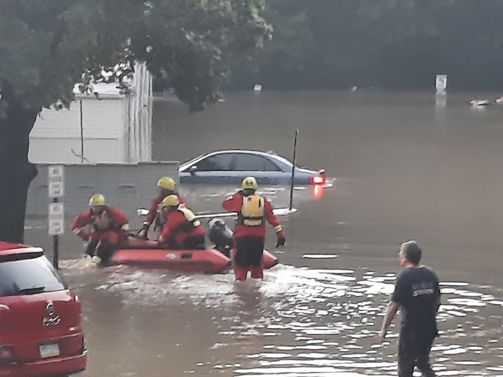
I am aghast at the loss of life in the recent flooding in Bucks County, Pa., as I am sure you are too.
Somehow, that they can’t find the body of a 9-month-old boy makes it all the more sorrowful. At least six other people also perished.
On July 15, a vehicle with a family was hit by a “wall of water” from Houghs Creek, according to Upper Makefield Fire Chief Tim Brewer.
Houghs Creek? Never heard of it. Yet it was turned into the source of a fatal flash flood.
Little otherwise-unremarkable creeks — in the water-rich Northeast we have lots of them — can have this power when heavy, heavy rains hit.
I’m looking at what is little more than a ditch in my backyard that runs with water only after rains come and I’m wondering, “What sort of storm could make that nondescript little stream overflow its banks and flood my basement?”
In the Hudson Valley in New York, on July 9, five to eight inches of rain fell, with the epicenter of the storm at West Point, the U.S. Military Academy in Orange County.
Catastrophic flooding also hit Vermont’s capital, Montpelier. It was deluged with a record-setting 5.28 inches of rain. That’s more than any other day on record, including when Irene dropped 5.27 inches on Aug. 28, 2011.
These recent catastrophes are rain events: Five inches, eight inches, even nine inches falling and streams overflow, streets become impassable, cars and homes get washed away and people die.
We are seeing in these weather events the footprint of climate change. When the atmosphere warms up, it can hold more water. When storms come, especially if they stall, the amount of water they can release can be devastating — often in a very specific area.
The never-imagined situations we’re all facing include the confounding fact that even though this wall of water rushed through Bucks County, ALL of Pennsylvania, including Bucks County, has been in a drought watch.
The odd fact is that, despite the rush of water, that rush carries the water away and it doesn’t soak into the ground. By the time you’re reading this, we’ll have had another meeting of the Commonwealth Drought Task Force on July 26, so we’ll see what the state of play is at that point.
Remember that the calculation of drought rests on four observations: stream flow, groundwater level, precipitation and soil moisture. And we are in the first of three stages: Drought Watch, Drought Warning and Drought Emergency.
I’m getting ready to go down to Philly and before I go, I’m going to read up on what rain is predicted — it’s starting to thunder in my neck of the woods.
I’ve discovered something called the Storm Prediction Center, which offers hazardous weather outlooks. I’ll read the latest forecast as I make up my mind about venturing forth — when to go and even whether I should. Heavy rain is predicted as well as the danger of flash floods in, once again, Bucks County and in Philly.
It occurs to me that there is lots of good information out there about hazardous weather that we should all be getting familiar with. I’ll be investigating them over the next few weeks and sharing what I find with you in my newsletter.
Be safe out there!


![DC_Image [Image 4_Assunpink Meets Delaware] meets Delaware The Assunpink Creek on its its way to meet the Delaware River. The creek passes through woods, industrial and commercial areas and spots both sparkling and filled with litter.](https://delawarecurrents.org/wp-content/uploads/bb-plugin/cache/DC_Image-4_Assunpink-meets-Delaware-1024x768-landscape-14f069364113da5e8c145e04c9f2367c-.jpg)


