A ‘Paddlers’ Guide to the Delaware River’ will not steer you wrong
| August 17, 2023
Gary Letcher spent a career in environmental law, retired in 2016 and says that creating paddlers’ guides to the Delaware River is now his “new job.” In truth, though, writing these books has been a calling dating to his days as a high schooler.
Letcher’s exposure to the river began in the 1970s as a participant, and later as a leader, of the Youth Conservation Corps in Stokes State Forest in Sussex County in New Jersey.
Part of the corps’ activities included biking and hiking as well as canoeing on the river. Realizing at the time that there were no good guides to the river — “they were very ad hoc,” Letcher says — he created his own.
That set the stage for what would later become his early guides, “Canoeing the Delaware” in 1985 and 1997.
A third edition, in 2012, “A Paddler’s Guide to the Delaware River: Kayaking, Canoeing, Rafting, Tubing,” took into account the explosive growth and interest in other forms of paddling the river, hence the more-inclusive change in title.
And in May, a fourth edition, “Paddlers’ Guide to the Delaware River,” was released.
This latest edition, published under his own imprint, Penn Del Press, features for the first time color photos and maps.

He said he plans to update the book roughly every year. He’s already marked a copy of the latest edition with at least 30 red tabs sticking out like porcupine quills, highlighting places for additions and revisions.
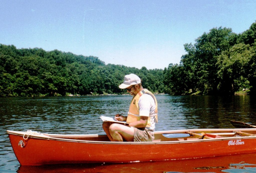
The latest edition reflects layers of research gathered in the field and recorded in a spiral-bound notebook.
“I would sometimes frustrate my paddle buddies because I would be taking notes while they did all the work,” recalled Letcher, 70, who lives in Lewes, Del.
He drew on Delaware River Basin Commission recreational maps as foundational material and credits the final product as being truly a collaborative effort.
He relied heavily on the DRBC, particularly its executive director, Steve Tambini, who wrote the foreword; and Kate Schmidt, who is on the commission’s communications staff. Letcher also interviewed Laurie Ramie, executive director of the Upper Delaware Council, and recreational outfitters and staff members of the National Park Service units on the river.
In addition, he solicited photos from participants on the Delaware River Sojourn, resulting in about 15 contributed photos that populate the book.
Witness to lots of changes over time
Letcher’s guide is chock full of history and informative tidbits. The book highlights geographic features, historical sites and landmarks, bridges, geographic features and accommodations and facilities along the way.
“I think that the names of places are as important to paddlers now as they were to the rafters and the landowners who originally named them,” he said.
He said he tried to deliver a paddler’s point of view, providing a sense of what someone on the river would see. Indeed, to read the guide is to get a mile-by-mile narration of life on the river — both then and now.
For instance, at mile 284, he writes: “The Ten-Mile River enters, New York side, at a gravel bar extending into the river. Look up Ten-Mile River to see a beautiful stone-arch bridge, built in 1875. Timber rafters looked forward to the hotels and taverns at Barryville 10 miles from this confluence, hence the name of the river.”
Letcher offers a play-by-play of navigating the river, including warnings of rapids, hazards and other places to exercise caution. The book includes this pointed reminder: “The river is more powerful than you. Respect it.”
(His site, delawareriverguide.com, offers waterproof river maps and real-time updates from U.S. Geological Survey gauges on river conditions at six locations: Callicoon, Barryville, Port Jervis, Delaware Water Gap, Riegelsville and Trenton.)
Over the decades, camp and access sites have become much more controlled compared to decades ago when paddlers could practically pick a spot at random, Letcher said. Ultimately, though, those controls have been beneficial, he added, otherwise river traffic would be unmanageable today.
Letcher said he’s seen steady improvements in the river’s health and a reappearance of wildlife (eagles, in particular), as a result of enhanced regulatory protections.
The other significant change is the way people get around on the river, he said.
Kayakers make up 90 percent of river traffic today compared to canoeists, who were once the overwhelming majority of those on the Delaware. Canoes cost about $2,000 while kayaks can be bought for $300 at Walmart, he said. And tubes are even less expensive.
As for the allure of the river and why he’s so dedicated to it, Letcher said, “it does feel like magic” because paddling on so many sections of the river can make you believe you are in wilderness, even though civilization is only a few miles away.
As he notes in his latest guide: “It is easier than ever to experience the thrill of the rapids, the serenity of the eddies and the magnificence of the valley of what is still one of the most beautiful, best and pleasantest rivers in the world.”


